
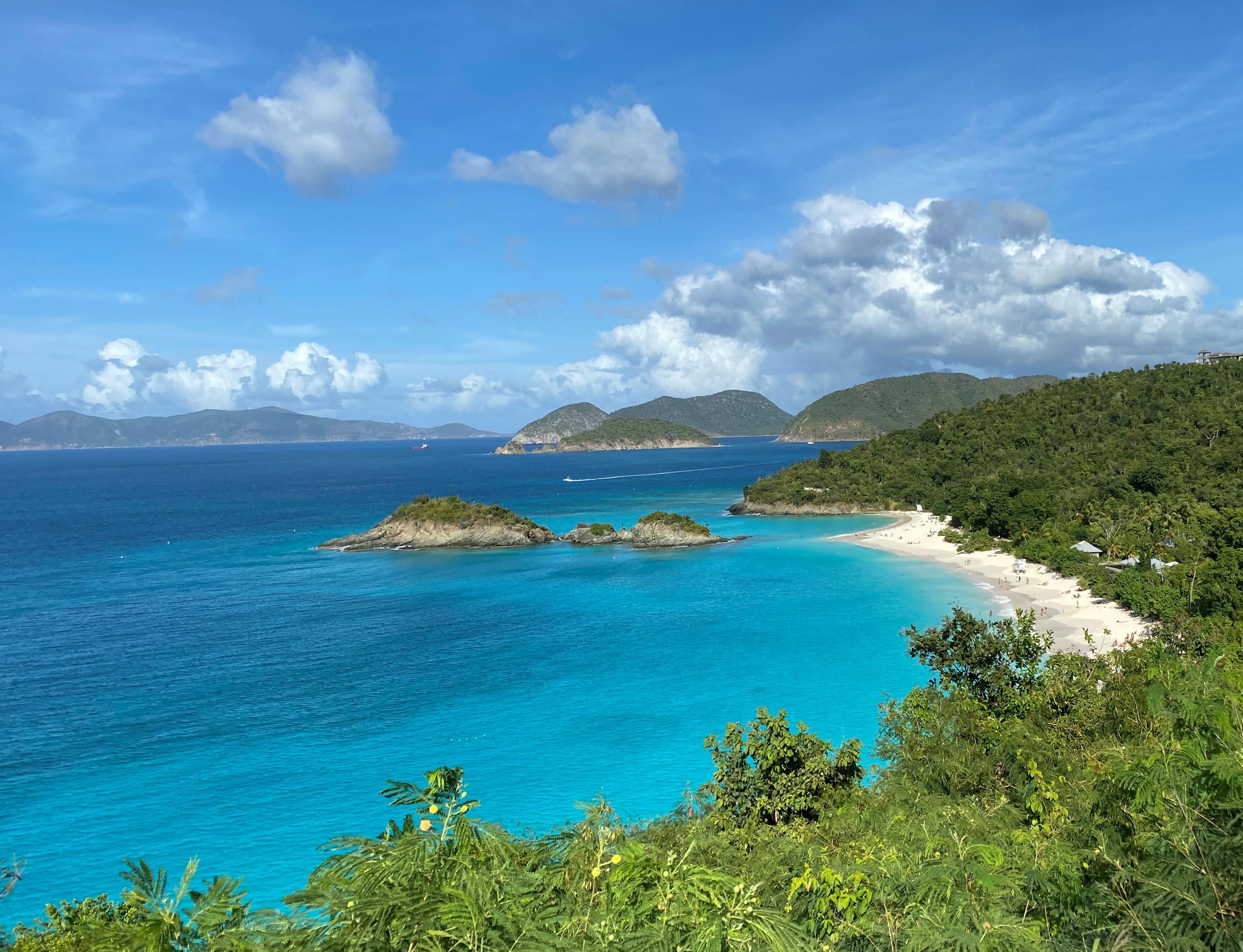
The best hikes in Virgin Islands National Park are the Reef Bay Trail for petroglyphs and sugar-mill ruins, the Ram Head Trail for the park's most dramatic sea cliff, the Leinster Bay Trail for easy walking straight into world-class snorkeling, and the Lind Point Trail if you only have a few hours off the ferry. The park protects roughly 60% of St. John, and almost every trail is short — this is a place where a two-mile hike can deliver ruins, a cactus headland, and a beach you swim from afterward.
Which trail should you hike first?
Start with the Leinster Bay Trail. It runs about 0.8 miles along an old Danish estate road, flat and shaded, from the Annaberg area out to the point opposite Waterlemon Cay. The walking is genuinely easy, and the payoff is the snorkeling: green sea turtles graze the seagrass beds, and spotted eagle rays pass through the channel. Pair it with the short paved loop through the Annaberg Sugar Plantation ruins at the trailhead and you have a morning that covers both the ecology and the colonial history of the island in under two hours.
If you arrive by ferry into Cruz Bay with no car, the Lind Point Trail starts directly behind the visitor center. About 1.1 miles gets you to Honeymoon Beach, with an upper and lower fork — the upper fork climbs to an overlook, the lower fork stays closer to the shoreline.
What is the Reef Bay Trail like?
Reef Bay is the park's signature hike and the one people plan a day around. From the Centerline Road trailhead it descends roughly 2.2 miles through moist forest to Reef Bay beach, dropping around 900 feet. Two spurs matter: one leads to a freshwater pool ringed by pre-Columbian Taino petroglyphs carved into the rock face, and the other reaches the ruins of the Reef Bay sugar factory, where the steam machinery is still standing.
The catch is the return. Hiking back up the same 900 feet in Caribbean heat and humidity is far harder than the descent, and there is no water on the trail. The National Park Service has historically run a ranger-guided version with a boat pickup at the bottom; whether it is operating and how to book it changes, so check the current-year rules on the park page before you count on it.
Which hike has the best view?
The Ram Head Trail. From Salt Pond Bay it runs about a mile over a cobble beach and up through dry cactus scrub to a blue-basalt headland roughly 200 feet above the water, with open ocean on three sides. It is completely exposed, so go early or late — this is the classic St. John sunrise hike.
For a different kind of view, Caneel Hill climbs steeply to an observation deck around 719 feet, looking north across Pillsbury Sound to St. Thomas. And Bordeaux Mountain Trail drops about 1.2 miles and 1,000 feet from near the island's high point (Bordeaux Mountain, 1,277 feet) down to Lameshur Bay — a knee-punishing descent with a stiff climb out.
Are there easy hikes for a short visit?
Several, and they are worth doing rather than settling for. The Cinnamon Bay Nature Loop is a flat half-mile past Danish plantation ruins. The Francis Bay Trail is a short boardwalk over a salt pond and one of the better birding spots in the park. The Salt Pond Bay Trail is a five-minute walk down to a sheltered swimming beach, and it doubles as the start of Ram Head. The Yawzi Point Trail from Little Lameshur is about 0.3 miles out to a rocky point with good shore snorkeling on both sides.
When should you hike on St. John?
Early. Trailheads are quiet before 8 a.m., the temperature is manageable, and parking at popular spots like Salt Pond Bay and Leinster Bay is limited. December through April is the dry season and the busiest stretch; late summer and autumn are hotter, wetter, and fall inside Atlantic hurricane season. The 2017 hurricanes reshaped several trails and some sections have been rerouted or rebuilt since, so confirm current trail status with the park before setting out on the longer routes.
What should you bring?
More water than feels reasonable — there is none on any trail. Add real footwear with grip (the volcanic rock is slick when wet), reef-safe sunscreen, a dry bag if you plan to swim after, and a printed or offline map, since cell coverage drops out on the south and east sides of the island. Watch for manchineel trees near the beaches; their sap blisters skin and the fruit is toxic, and the park marks them where it can.
Where else can you hike like this?
If the Caribbean park bug bites, Buck Island Reef National Monument off St. Croix has an island loop trail and an underwater snorkel trail, and Salt River Bay and Christiansted National Historic Site round out the territory — all listed on our U.S. Virgin Islands guide. On the mainland, Dry Tortugas and Biscayne offer the closest equivalent mix of short trails and serious snorkeling. Full details and current conditions live on the Virgin Islands National Park page.
FAQ
How long is the Reef Bay Trail?
About 2.2 miles one way from the Centerline Road trailhead down to Reef Bay, with roughly 900 feet of elevation loss. Adding the petroglyph and sugar factory spurs brings it closer to 3 miles each way, and the uphill return is the hard part.
Do you need a car to hike in Virgin Islands National Park?
Not for everything. The Lind Point and Caneel Hill trails start within walking distance of the Cruz Bay ferry dock, and taxis run to Trunk Bay, Cinnamon Bay and Annaberg. A car makes the south-side trailheads — Salt Pond Bay, Lameshur, Bordeaux Mountain — far easier to reach.
What is the hardest hike in the park?
Bordeaux Mountain Trail, for the sustained 1,000-foot climb back out from Lameshur Bay, closely followed by the Reef Bay return. Neither is technical; both are punishing in the heat.
Is there an entrance fee to hike?
The trails themselves are generally free to walk, but Trunk Bay and the Annaberg ruins have historically charged a use fee, and fee structures change. Check the current-year rules before you go.
Can you snorkel at the end of the hikes?
Yes, and you should. Leinster Bay reaches the Waterlemon Cay snorkel, Salt Pond Bay and Yawzi Point both have good shore entries, and Reef Bay ends at a quiet beach. Carry a mask on almost any of these trails.