
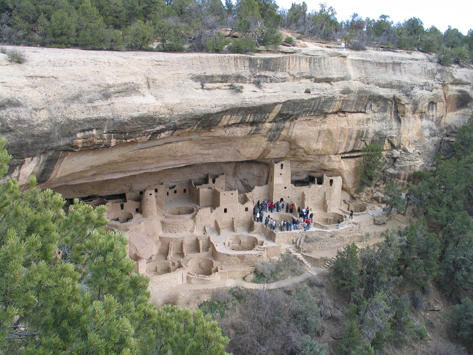
The best hikes in Mesa Verde National Park are Petroglyph Point Trail, Point Lookout Trail, Soda Canyon Overlook Trail, Knife Edge Trail, Prater Ridge Trail and the Step House loop on Wetherill Mesa. Mesa Verde is unusual among national parks: it protects roughly 5,000 archaeological sites rather than a single scenic centerpiece, so its trail system is short, tightly regulated, and built around what the Ancestral Pueblo people left behind. Most trails run under 3 miles, but at 7,000–8,500 feet of elevation they feel longer than the numbers suggest.
Which Mesa Verde trails require registration?
This is the detail that catches most first-time visitors. Petroglyph Point Trail and Spruce Canyon Trail both begin near the Chapin Mesa Archeological Museum, and hikers have traditionally been required to register at the trailhead or ranger station before setting out and sign back in on return. It is a backcountry-style safety measure on a trail barely two miles long, and rangers do enforce it. Check the current-year rules before you go, since registration points and hours shift seasonally.
Everything else in the park — Point Lookout, Knife Edge, Prater Ridge, Soda Canyon Overlook, Farming Terrace — is open self-guided hiking with no sign-in. Off-trail travel is prohibited everywhere in the park to protect unexcavated sites.
What is the best hike in Mesa Verde for seeing rock art?
Petroglyph Point Trail, a 2.4-mile loop, is the only trail in Mesa Verde that reaches an accessible petroglyph panel. The route squeezes through a slot between boulders, traverses a cliff shelf below the mesa rim, and delivers you to a large panel of carved spirals, handprints and figures. You then climb a short set of hand-and-toe holds to the mesa top and return on a flat plateau path. It is the most rewarding two and a half miles in the park, and the scrambling section makes it a poor choice for anyone uneasy with exposure.
Which hikes have the best views?
Point Lookout Trail (about 2.2 miles round trip, roughly 400 feet of gain) switchbacks up to a promontory above the park entrance with a sweeping view over the Montezuma Valley and Mancos Valley. Knife Edge Trail is the easy alternative: 2 miles round trip on an old roadbed with almost no elevation change, and it is the park's classic sunset walk. Both start near Morefield Campground, which makes them ideal for an evening after a full day on the mesa-top loops.
Soda Canyon Overlook Trail is the sleeper pick — 1.2 flat miles to overlooks that give you a distant, uncrowded view straight across the canyon at Balcony House. If you cannot get a tour ticket, this is how you still see it.
What is the longest hike in Mesa Verde?
Prater Ridge Trail, a 7.8-mile loop from Morefield Campground, is the longest trail in the park. It climbs onto a ridge above the campground and offers views both west toward the Montezuma Valley and east into Prater Canyon. There is a cut-across option that shortens it to roughly 5 miles. Carry more water than you think you need — there is no shade for long stretches and no water on the route.
Can you hike to a cliff dwelling on your own?
Yes, but only one. Step House on Wetherill Mesa is reached by a roughly 1-mile round-trip trail that descends into the canyon and is the park's only cliff dwelling you can enter without a ranger-guided ticket. Cliff Palace, Balcony House and Long House all require ticketed ranger-guided tours, and Spruce Tree House has been closed to entry for years due to rockfall — you can still view it from the overlook above. The Wetherill Mesa road is seasonal and typically closed outside the warm months, so check the current-year schedule before planning around Step House.
How should you plan a Mesa Verde hiking day?
Mesa Verde rewards a two-day visit. Spend day one on Chapin Mesa — Petroglyph Point in the cool morning, the Mesa Top Loop Road with the short Farming Terrace Trail, and a ranger tour if you secured a ticket. Save day two for Wetherill Mesa and Step House, then finish with Knife Edge at sunset. It pairs naturally with the rest of Colorado's national parks: Black Canyon of the Gunnison is a reasonable drive northeast, and Great Sand Dunes makes a natural next stop heading east. Full details on hours, fees and tours live on our Mesa Verde National Park page, and you can browse the rest of the system from our parks directory.
FAQ
How many hiking trails are in Mesa Verde National Park?
Mesa Verde has roughly a dozen maintained trails, most of them under 3 miles. The park deliberately keeps its trail network small because off-trail travel would threaten thousands of unexcavated archaeological sites.
What is the hardest hike in Mesa Verde?
Prater Ridge Trail is the longest at 7.8 miles, but Petroglyph Point Trail is usually considered the most technically demanding because of its narrow cliff-shelf sections and a short hand-and-toe-hold climb near the end.
Do you need a permit to hike in Mesa Verde?
No backcountry permit is required, but Petroglyph Point and Spruce Canyon trails have required trailhead registration. Ranger-guided cliff dwelling tours require separately purchased tickets. Check the current-year rules before your visit.
When is the best time to hike in Mesa Verde?
Late spring and early fall offer the most comfortable hiking. Summer afternoons on the mesa are hot and exposed with afternoon thunderstorms, and winter closes the Wetherill Mesa road and can leave ice on shaded trail sections.
How high is Mesa Verde National Park?
Chapin Mesa sits near 7,000 feet and Park Point, the park's high point, reaches about 8,572 feet. Visitors arriving from sea level should expect short trails to feel noticeably harder.